

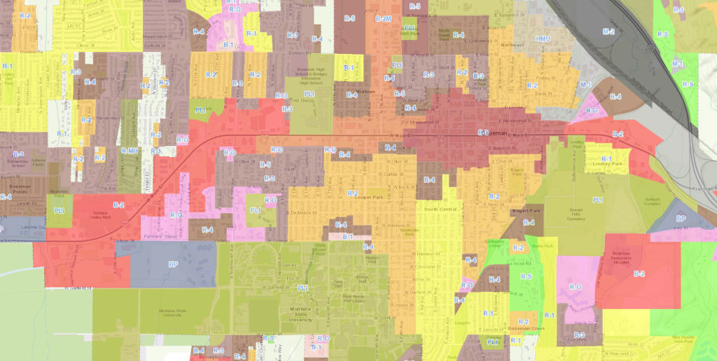
Bozeman Zoning
R-S |
Residential Suburban District The intent and purpose of the R-S residential suburban district is to allow open space, resource protection and primarily single-household development in circumstances where environmental constraints limit the desirable density. |
R-1 |
Residential Single-Household Low Density District
The intent of the R-1 residential single-household low density district is to provide for primarily single-household residential development and related uses within the city at urban densities, and to provide for such community facilities and services as will serve the area’s residents while respecting the residential character and quality of the area. |
R-2 |
Residential Two-Household Medium Density District The intent of the R-2 residential two-household medium density district is to provide for one- and two-household residential development at urban densities within the city in areas that present few or no development constraints, and for community facilities to serve such development while respecting the residential quality and nature of the area. |
R-3 |
Residential Medium Density District The intent of the R-3 residential medium density district is to provide for the development of one- to five-household residential structures near service facilities within the city. It should provide for a variety of housing types to serve the varied needs of households of different size, age and character, while reducing the adverse effect of nonresidential uses. |
R-4 |
Residential High Density District The intent of the R-4 residential high density district is to provide for high-density residential development through a variety of housing types within the city with associated service functions. This will provide for a variety of compatible housing types to serve the varying needs of the community’s residents. Although some office use is permitted, it shall remain as a secondary use to residential development. Secondary status shall be as measured by percentage of total building area. |
R-5 |
Residential Mixed-Use High Density District The intent of the R-5 residential mixed-use high density district is to provide for high-density residential development through a variety of compatible housing types and residentially supportive commercial uses in a geographically compact, walkable area to serve the varying needs of the community’s residents. Offices and small scale retail and restaurants are allowed as secondary uses provided special standards are met. |
R-O |
Residential-Office District The intent of the R-O residential-office district is to provide for and encourage the development of multihousehold and apartment development and compatible professional offices and businesses that would blend well with adjacent land uses. The primary use of a lot, as measured by building area, permitted in the R-O district is determined by the underlying growth policy land use designation. Where the district lies over a residential growth policy designation the primary use shall be non-office uses; where the district lies over a nonresidential designation the primary use shall be office and other nonresidential uses. Primary use shall be measured by percentage of building floor area. |
RMH |
Residential Manufactured Home Community District The intent of the RMH residential manufactured home community district is to provide for manufactured home community development and directly related complementary uses within the city at a density and character compatible with adjacent development. The district is intended to be residential in character and consistent with the standards for other forms of residential development permitted by this chapter. |
B-1 |
Neighborhood Business District The intent of the B-1 neighborhood business district is to provide for smaller scale retail and service activities frequently required by neighborhood residents on a day to day basis, as well as residential development as a secondary purpose, while still maintaining compatibility with adjacent residential land uses. Development Scale and pedestrian orientation are important elements of this district. |
B-2 |
Community Business District The intent of the B-2 community business district is to provide for a broad range of mutually supportive retail and service functions located in clustered areas bordered on one or more sides by limited access arterial streets. |
B-2M |
Community Business District—Mixed The intent of the B-2M community business district—mixed is to function as a vibrant mixed-use district that accommodates substantial growth and enhances the character of the city. This district provides for a range of commercial uses that serve both the immediate area and the broader trade area and encourages the integration of multifamily residential uses as a secondary use. |
B-3 |
Central Business District
The intent of the B-3 central business district is to provide a central area for the community’s business, government service and cultural activities. Uses within this district should be appropriate to such a focal center with inappropriate uses being excluded. Room should be provided in appropriate areas for logical and planned expansion of the present district. It is the intent of this district to encourage high volume, pedestrian-oriented uses in ground floor space in the “core area” of the city’s central business district, i.e., along Main Street from Grand to Rouse and to the alleys one-half block north and south from Main Street. Lower volume pedestrian uses such as professional offices may locate on ground floor space in the B-3 area outside the above-defined core. |
UMU |
Urban Mixed-Use District The intent and purposes of the urban mixed-use (“UMU”) district is to establish areas within the city that are mixed-use in character, and to set forth certain minimum standards for development within those areas which encourage vertical mixed-use development with high density. The purpose in having an urban mixed-use district is to provide options for a variety of employment, retail and community service opportunities within the community, with incorporated opportunity for some residential uses, while providing predictability to landowners and residents in uses and standards. There is a rebuttable presumption that the uses set forth for each district will be compatible both within the individual districts and to adjoining zoning districts when the standards of this chapter are met and any applicable conditions of approval have been satisfied. Additional requirements for development apply within overlay districts. |
M-1 |
Light Manufacturing District The intent of the M-1 light manufacturing district is to provide for the community’s needs for wholesale trade, storage and warehousing, trucking and transportation terminals, light manufacturing and similar activities. The district should be oriented to major transportation facilities yet arranged to minimize adverse effects on residential development, therefore, some type of screening may be necessary. |
M-2 |
Manufacturing and Industrial District The intent of the M-2 manufacturing and industrial district is to provide for heavy manufacturing and industrial uses, servicing vocational and employment needs of city residents. |
B-P |
Business Park District The intent of the B-P business park district is to provide for high quality settings and facilities for the development of a variety of compatible employment opportunities. These areas should be developed so as to recognize the impact on surrounding or adjacent development and contribute to the overall image of the community. Compatibility with adjacent land uses and zoning is required. |
PLI |
Public Lands and Institutions District The intent of the PLI public lands and institutions district is to provide for major public and quasi-public uses outside of other districts. Not all public and quasi-public uses need to be classified PLI. Some may fit within another district, however larger areas will be designated PLI. |
NEHMU |
Northeast Historic Mixed-Use District
The intent of the northeast historic mixed-use district is to provide recognition of an area that has developed with a blend of uses not commonly seen under typical zoning requirements. The unique qualities and nature of the area are not found elsewhere in the city and should be preserved as a place offering additional opportunities for creative integration of land uses. The intent of this area is to allow private and case-by-case determination of the most appropriate use of land in a broad range of both nonresidential and residential uses. Standards for buffering between different land uses are deliberately not as high as standards elsewhere in the community as it is assumed that persons choosing to locate in this area are aware of the variety of possible adjacent land uses and have accepted such possibilities as both acceptable and desirable. It is expected that the lots within this district will continue to develop under a variety of uses which may increase or decrease in scope in any given portion of the district.
The clear intent of this district is to support a mix and variety of nonresidential and residential uses. Nothing in this article shall be interpreted to be discouraging or prejudicial to any listed use except as set forth as principal and conditional uses. |
NC |
Neighborhood Conservation Overlay District The intent and purpose of the Neighborhood Conservation Overlay District designation is to stimulate the restoration and rehabilitation of structures, and all other elements contributing to the character and fabric of established residential neighborhoods and commercial or industrial areas. New construction will be invited and encouraged provided primary emphasis is given to the preservation of existing buildings and further provided the design of such new space enhances and contributes to the aesthetic character and function of the property and the surrounding neighborhood or area. Contemporary design will be encouraged, provided it is in keeping with the above-stated criteria, as an acknowledged fact of the continuing developmental pattern of a dynamic, changing community. |
EO |
Entryway Corridor Overlay District There are several arterial corridors entering the city that introduce visitors and residents alike to the city. The visual attributes of these roadways provide a lasting impression of the character of the city. It is the intent and purpose of this article to ensure that the quality of development along these corridors will enhance the impression and enjoyment of the community by guiding development and change, and by stimulating and assisting, in conjunction with other provisions of this chapter, improvements in signage, landscaping, access and other contributing elements of entry corridor appearance and function. |
CO |
Casino Overlay District The intent of the casino overlay district is to provide suitable locations for casinos, as defined in this chapter, based on review for impacts to neighboring uses and to minimize adverse effects on the community in the best interests of the public health, safety and general welfare. |
REMU |
Residential Emphasis Mixed-use District The intent and purpose of the residential emphasis mixed-use (REMU) district is to establish areas within Bozeman that are mixed-use in character and to provide options for a variety of housing, employment, retail and neighborhood service opportunities within a new or existing neighborhood, while providing predictability to landowners and residents in uses and standards. There is a rebuttable presumption that the uses set forth for the district will be compatible both within the district and to adjoining zoning districts when the standards of this chapter are met and any applicable conditions of approval have been satisfied. Additional requirements for development apply within overlay districts. |
Bozeman Residential Zoning Districts
| R-S | R-1 | R-2 | R-3 | R-4 | R-5 | R-O | RMH | |
|---|---|---|---|---|---|---|---|---|
| Accessory dwelling units 8,9 | C | C | P | P | P | P | P | — |
| Agricultural uses on 2.5 acres or more 2 | P | — | — | — | — | — | — | — |
| Agricultural uses on less than 2.5 acres 2 | C | — | — | — | — | — | — | — |
| Apartments/apartment building, as defined in Article 42 | — | — | — | — | P | P | P | — |
| Bed and breakfast | C | C | C | C | P | P | P | — |
| Commercial stable | C | — | — | — | — | — | — | — |
| Community centers | C | C | C | C | C | C | P | C |
| Community residential facilities with eight or fewer residents | P | P | P | P | P | P | P | P |
| Community residential facilities serving nine or more residents | — | — | — | C | P | P | P | — |
| Cooperative housing | C | C | C | P | P | P | P | C |
| Cottage Housing | — | P | P | P | P | P | P | P |
| Day care centers | C | C | C | P | P | P | P | C |
| Essential services Type I | A | A | A | A | A | A | A | A |
| Essential services Type II | P | P | P | P | P | P | P | P |
| Essential services Type III | C 10 | C 10 | C 10 | C 10 | C 10 | C 10 | C 10 | C 10 |
| Extended stay lodgings | C | C | C | P | P | P | P | — |
| Family day care home | P | P | P | P | P | P | P | P |
| Fences | A | A | A | A | A | A | A | A |
| Fraternity and sorority houses | — | — | — | C | P | — | P | — |
| Golf courses | C | C | C | — | — | — | — | C |
| Greenhouses | A | A | A | A | A | A | A | — |
| Group day care home | P | P | P | P | P | P | P | P |
| Group living | P | P | P | P | P | P | P | P |
| Guesthouses | A | A | A | A | A | A | A | — |
| Home-based businesses 5 | A/C | A/C | A/C | A/C | A/C | A/C | A/C | A/C |
| Lodging houses | — | — | — | C | P | P | P | — |
| Offices | — | — | — | — | C3 | C 3 | P | — |
| Other buildings and structures typically accessory to authorized uses | A | A | A | A | A | A | A | A |
| Private garages | A | A | A | A | A | A | A | A |
| Private or jointly owned recreational facilities | A | A | A | A | A | A | A | A |
| Private stormwater control facilities | A | A | A | A | A | A | A | A |
| Private vehicle and boat storage | A | A | A | A | A | A | A | A/C 4 |
| Public and private parks | P | P | P | P | P | P | P | P |
| Manufactured homes on permanent foundations 1 | P | P | P | P | P | P | P | P |
| Manufactured home communities | — | — | — | — | — | — | — | P |
| Medical offices, clinics, and centers | — | — | — | — | C | C 3 | P | — |
| Recreational vehicle parks | C | — | — | — | — | — | — | P |
| Restaurant | — | — | — | — | — | P 11 | — | — |
| Retail | — | — | — | — | — | P 11 | — | — |
| Signs, subject to Article 28 | A | A | A | A | A | A | A | A |
| Single-household dwelling | P | P | P | P | P | P | P | P |
| Temporary buildings and yards incidental to construction work | A | A | A | A | A | A | A | A |
| Temporary sales and office buildings | A | A | A | A | A | A | A | A |
| Three- or four-household dwelling | — | — | — | P | P | P | P | — |
| Two-household dwelling | — | — | P | P | P | P | P | — |
| Townhouses (two attached units) | P7 | P7 | P | P | P | P | P | P 7 |
| Townhouses (five attached units or less) | — | — | — | P6 | P | P | P | — |
| Townhouses (more than five attached units) | — | — | — | — | P | P | P | — |
| Tool sheds for storage of domestic supplies | A | A | A | A | A | A | A | A |
| Uses approved as part of a PUD per Article 20 | C | C | C | C | C | C | C | C |
| Veterinary uses | C | — | — | — | — | — | — | — |
Category : Bozeman Information , Data Center